History
For alternative information or amendment requests, please share your feedback.
Forged by Conflict and Commerce:
A History of the Battlemont Neighborhood
Introduction: The Layers of Battlemont
The Battlemont neighborhood of Nashville is a landscape where history is not merely documented but physically inscribed. Its identity is a palimpsest, with each era of its past—from the ancient settlements of its indigenous inhabitants and the sprawling antebellum estates that followed, to the crucible of civil war and the transformative waves of 20th-century suburbanization—leaving a tangible layer upon the land. To understand Battlemont is to read these layers, to see how the dual themes of its name—"Battle," for the conflict that defined its soil, and "Mont," for the rolling hills that cradled its estates—have shaped its story. This report traces the neighborhood's evolution, beginning with its deepest roots as a significant site for prehistoric peoples, moving through the vast 19th-century landholdings of Nashville's elite, through the decisive Battle of Nashville, and into the two distinct periods of development that created the community seen today. The analysis will validate the foundational knowledge of its origins with prominent landowner O.F. Noel and its primary construction in the mid-20th century, while providing a more nuanced exploration of the forces that forged its unique character. By examining the area through the analytical frameworks of the "streetcar suburb" and the later "automobile suburb," the neighborhood's development reveals itself not as a single event, but as a dynamic process driven by technology, economics, and a conscious cultivation of historical identity.1
Chapter 1
The Ancient Land:
Indigenous Peoples and Prehistory
Long before the first European settlers arrived, the land that would become Battlemont was a significant center for a sophisticated prehistoric society and, later, a prized hunting ground for several powerful Native American tribes. This ancient history forms the foundational layer of the neighborhood's story.
1.1 The Mississippian Era and the Noel Cemetery
The peak of prehistoric cultural development in Middle Tennessee occurred during the Mississippian period, from approximately 900 to 1500 AD. The people of this era, known as the Middle Cumberland Mississippian culture, were known for their large, organized towns, maize-based agriculture, and the construction of substantial earthen mounds for temples and the homes of their elite. Crucially, the very land that O.F. Noel would later consolidate into his "Noelton" estate was the site of one of the largest and most significant of these prehistoric sites: the Noel Cemetery. This was not a small burial ground but an extensive mortuary complex, estimated to have contained thousands of stone-lined graves, indicating a large and long-settled population in the immediate area. Archaeological investigations have revealed a complex society with elaborate burial rituals and finely crafted artifacts.3 The presence of this major cemetery directly on the land establishes a profound indigenous history tied to the specific location of the Battlemont neighborhood.4 This vibrant Mississippian culture appears to have vanished from the Nashville area by about 1475-1500 AD, possibly due to a combination of drought, disease, and conflict.
1.2 A Contested Hunting Ground
Following the decline of the Mississippian peoples, the region of Middle Tennessee became a vast and prized hunting ground, though without large-scale permanent settlements for a time.
By the late 1600s, the Shawnee had established numerous villages along the Cumberland River, which was even identified on early French maps as the "River of the Shawnees". The natural salt lick near present-day downtown Nashville, which attracted abundant game, became the site of a French trading post known as "French Lick," established to trade with the Shawnee.
The Shawnee's presence was contested. The Cherokee and the more powerful Chickasaw tribe challenged them for control of these rich hunting grounds. In 1714, and again in 1745, the Cherokee and Chickasaw allied to drive the Shawnee from the region.
1.3 Arrival of Settlers and Removal
After the Shawnee were pushed out, the area remained a common hunting ground for tribes like the Cherokee and Chickasaw. The Chickasaw, whose main villages were in northern Mississippi, claimed all of West Tennessee and a portion of Middle Tennessee as their hunting territory. The Cherokee were centered in East Tennessee but also used the land for hunting. The arrival of James Robertson's party of white settlers at Fort Nashborough in 1779 marked the beginning of the end for native control of the area. This immediately sparked years of intense conflict, particularly with a faction of the Cherokee known as the Chickamauga, who fiercely resisted the encroachment on their ancestral lands. While the Chickasaw initially raided the new settlements, they later made peace and became crucial allies to the settlers, protecting them from other hostile groups. However, a series of treaties between the U.S. government and the native nations, including the Treaty of Holston (1791) with the Cherokee and various land cessions with the Chickasaw, steadily eroded their land holdings. Ultimately, the Indian Removal Act of 1830 led to the tragic and forcible removal of the Cherokee in 1838 along the Trail of Tears, a route that passed through Nashville, securing the area for American expansion.
Chapter 2
The Lay of the Land:
From Antebellum Estates to Battlefield
Before Battlemont was a collection of homes and streets, it was a vast expanse of rolling farmland south of Nashville, a region favored by the city's affluent citizens for their country estates in the 19th century.5 The story of the land itself is a direct causal chain, where the commercial success of a few powerful men enabled the consolidation of rural tracts that would, through the violent interruption of war, become the foundation for a future suburb.
2.1 The Antebellum Landscape
The specific history of the land that would become Battlemont begins long before the Noel family's arrival. The property's documented ownership traces back to a post-Revolutionary War land grant issued to Andrew Ewing, one of Nashville's pioneers, on February 8, 1792.6 The land was later conveyed to his son, Nathan Ewing. For decades, it remained a large agricultural tract on the rural fringe of a growing city. Prior to and following the Civil War, the property was owned by G.M.D. Cantrell, who erected the primary residence on the estate that would later be purchased by the Noel family.6 This establishes a crucial layer of ownership and development preceding the name most associated with the area's history.
2.2 The Noel Dynasty and the "Noelton" Estate
The arrival of Oscar Fitzallen (O.F.) Noel marked a new chapter for the land. O.F. Noel was a titan of Nashville's 19th-century commerce, a man whose immense wealth, derived from the flour and grain business, banking, and telecommunications, would fundamentally reshape the city's southern edge.8 As a founder of the Fourth and First National Bank and president of the Cumberland Telephone and Telegraph Company, Noel possessed the capital to engage in large-scale land acquisition.8 He purchased the Cantrell property on Granny White Pike and established the "Noelton" estate. Through continued acquisition, the Noel family's holdings swelled to an extraordinary 1,500 acres by the start of the Civil War, a massive domain that stretched from today's Belmont Park Terrace to Granny White Pike and north to Glen Echo Street, effectively forming the southern boundary of Nashville.8 It is critical, however, to distinguish this primary estate from another significant Noel family property nearby. In 1882, a different Noel, Dr. L.G. Noel, a successful dentist, purchased the historic "Sunnyside" mansion and its surrounding 140 acres.10 There is no known relation between O.F. Noel and Dr. L.G. Noel. Dr. L.G. Noel renamed his estate "Idlewild" and, like his relative, eventually participated in the area's residential development by selling off 116 acres of his own land to be platted for new homes.6 This demonstrates that the suburban growth of the area was fueled by land sales from at least two major, distinct Noel families. The financial power of men like O.F. Noel allowed for the creation of these vast, single-owner tracts, which, unlike more fragmented land holdings, were perfectly positioned for the large-scale, planned subdivisions that would follow in the next century.
2.3 The Crucible: The Battle of Nashville (December 15-16, 1864)
In December 1864, the pastoral landscape of the Noel family's estates was violently transformed into a battlefield. The hills south of Nashville, including the Overton Hills and what would become known as Shy's Hill, held immense strategic importance for the Union army's seven-mile-long defensive line protecting the city.12 On December 15 and 16, the decisive Battle of Nashville raged across this terrain. Historical maps of the conflict clearly show Union and Confederate positions and movements directly on the land that constitutes modern-day Battlemont, which at the time was the heart of the Noel farm.8 The fighting was particularly intense around key terrain features that anchored the Confederate line. The proximity of landmarks like the Belmont Mansion, which served as Union General Thomas Wood's headquarters, and the Sunnyside mansion, which was used as a field hospital, further cements the area's deep and direct connection to the conflict.12 The battle superimposed a powerful historical narrative onto the geography, forever changing the land's identity from a private estate to a site of national significance.
<
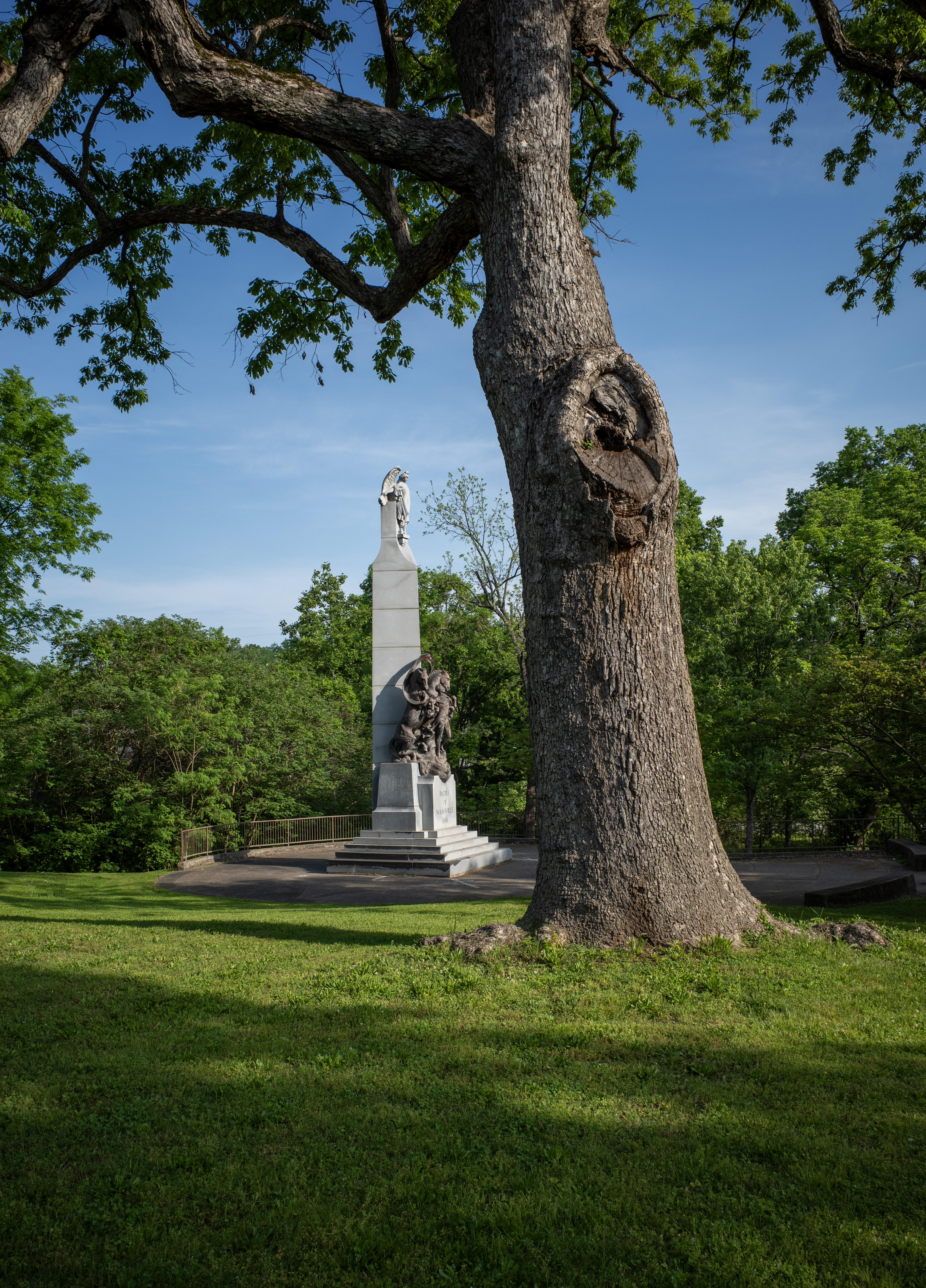
Witness Tree, photographed by neighbor Peyton Hoge
Chapter 3
The Birth of a Suburb:
The First Wave of Development (c. 1900-1940)
The transition from vast estate to residential neighborhood did not happen all at once. The first wave of home construction in the Battlemont area represents a fundamentally different vision of suburban life from what would follow, an artifact of a city oriented around public transit rather than the private automobile.
3.1 Nashville's Outward March
The period from the 1890s through the 1930s was the era of the "streetcar suburb" in Nashville.1 The extension of electric streetcar lines was the primary engine of urban expansion, allowing a growing middle class to move into new residential areas while still commuting to jobs in the city's core.17 The establishment of a streetcar line along Belmont Boulevard in 1901 was a key catalyst for development in the areas south of downtown.1 This new infrastructure spurred the subdivision of other large estates in the vicinity, creating the context for Battlemont's initial growth. The 1890 subdivision of Adelicia Acklen's famous Belmont estate and the platting of land from Dr. L.G. Noel's "Idlewild" estate gave rise to the adjacent Belmont-Hillsboro neighborhood, creating developmental pressure that naturally extended to the edges of O.F. Noel's massive Noelton property.1 The first lots in the Battlemont area were likely platted in a piecemeal fashion along these new, accessible transportation corridors.
3.2 Early Architectural Footprints
The homes built during this initial phase, starting around the turn of the 20th century, stand in distinct architectural contrast to the later building boom. The predominant styles of this era were the American Foursquare, the Tudor Revival, and various forms of bungalows and cottages.1 These styles reflected the aspirations of a rising middle class seeking respectable, sturdy, and fashionable homes. The American Foursquare, in particular, is a hallmark of this period in Nashville. These homes are characterized by a simple, boxy, two-story shape with a hipped roof rising to a central peak.19 They often feature a mix of materials, such as a first story of rock-faced stone with wood siding or shingles above, and a prominent front porch. Tudor Revival homes brought elements of English cottage style, while bungalows offered a more modest, single-story option. A key feature of these early homes is their orientation: they were designed for narrow, deep lots with small front yards, facing the street and the streetcar line that connected residents to the city.19 Built before the automobile became a household necessity, they typically lack integrated garages, a feature that would define the next generation of suburban housing. The architectural character of these early houses tells a story of a city in motion, connected by rails and public transit.
Chapter 4
The Post-War Boom:
The Making of Modern Battlemont (1945-1960s)
While the first homes in Battlemont appeared in the streetcar era, the neighborhood's definitive character was forged in the decades following World War II. The observation that the majority of its homes date to the 1940s and 1950s is the key to understanding its modern identity. Battlemont is a quintessential post-war American suburb, a product of national trends, new technologies, and a single, pivotal real estate transaction.
4.1 The Catalyst: The 1949 Noelton Estate Sale
The event that unlocked the large-scale development of Battlemont was the 1949 sale of the historic Noelton estate. Frances Noel Craig—the widow of O.F. Noel's grandson—sold the remaining six acres of the once-vast property to a developer named J.E. Crain.8 This transaction marked the definitive end of the estate era. The historic Noelton mansion was demolished to make way for the Stephen Foster apartment complex at 3401 Granny White Pike, a clear signal that the land's future lay not in aristocratic grandeur but in modern, high-density suburban housing.8 This sale provided the large, contiguous parcel of land necessary for the planned community that would soon emerge.
4.2 A Nation on the Move: The Post-War Context
The development of Battlemont cannot be understood in isolation; it was a local manifestation of powerful national forces that reshaped the American landscape after 1945. A confluence of factors created unprecedented demand for new housing: the return of millions of GIs from the war, the subsequent baby boom, and a robust post-war economy.2 The federal government actively encouraged this suburban expansion. The Federal Housing Administration (FHA) provided federally insured mortgages that made homeownership accessible to a broader segment of the population, while also standardizing construction practices and home design.2 Simultaneously, the explosion in automobile ownership fundamentally altered how and where people could live, severing the tie to fixed public transit lines and making more distant land developable.2 Developers across the country, including in Nashville, marketed these new subdivisions as idyllic escapes from the "smoke or dirt" of the city, promising clean air, safe streets, and a modern lifestyle for young families.20
4.3 The Architecture of a New America: Minimal Traditional and Ranch Homes
The housing stock built by developers like J.E. Crain in the late 1940s and 1950s was a direct response to this new market. The architectural styles that dominate Battlemont—the Minimal Traditional and the Ranch—were designed for efficiency, affordability, and a new, informal way of living.
In the years immediately following the war, the Minimal Traditional style met the urgent need for low-cost housing. Often called "GI Houses" or "FHA houses," these were simplified, stripped-down versions of more traditional styles like the Tudor or Colonial Revival.2 They typically feature a medium-pitched gable roof, a simple, unadorned facade, and a compact floor plan. Their design prioritized affordability and speed of construction above all else, making them the perfect product for the mass housing market of the late 1940s.
As the 1950s progressed and prosperity grew, the Ranch house became the quintessential style of the era, and its features are widespread in Battlemont. Evolving from the earlier Minimal Traditional, the Ranch house emphasized a horizontal orientation, with a low-pitched roof, wide eaves, and a rambling, one-story layout.2 Large picture windows and sliding glass doors aimed to blur the line between indoors and outdoors, connecting the home to its yard and reflecting a new focus on leisure and family life.22 Most importantly, the Ranch house was designed around the automobile. The attached garage or carport was a standard feature, a clear symbol of the car's central role in this new suburban lifestyle.2 The uniformity of style and era seen in Battlemont is not a coincidence; it is the hallmark of post-war development, where standardized plans and federal financing were used to mass-produce entire neighborhoods for a new generation of American homeowners. This architectural evolution, from the streetcar-oriented Foursquare to the car-centric Ranch, is a timeline written in brick and wood, clearly visible on the streets of Battlemont today.
Table 1: Architectural Characteristics of Battlemont Homes
| Feature | American Foursquare | Tudor Revival | Minimal Traditional | Ranch |
|---|---|---|---|---|
| Typical Era | c. 1900-1930 | c. 1910-1940 | c. 1940-1950 | c. 1950-1960s |
| Overall Shape | Square, two-story, vertical emphasis | Asymmetrical, one to two stories | Rectangular, compact, one story | Long, low, horizontal emphasis |
| Roof Type | Hipped roof with central peak | Steeply pitched gable roof, often with cross-gables | Medium-pitched gable roof | Low-pitched gable or hip roof with wide eaves |
| Materials | Brick, rock-faced stone, wood siding | Brick, stucco, stone, decorative half-timbering | Wood siding, brick veneer, asbestos shingles | Brick veneer, wood siding, stone accents |
| Window Style | Double-hung sash windows, often in groups | Tall, narrow windows, often in casement style | Simple double-hung or picture windows | Large picture windows, sliding glass doors |
| Porch/Garage | Full-width front porch; detached rear garage | Small entry porch or covered stoop; detached garage | Small stoop or covered entry; detached or no garage | Integrated carport or attached garage |
Source: Compiled from information in.1
Chapter 5
A Neighborhood Defined by the Interstate
The construction of the national interstate system in the mid-20th century added another profound and permanent layer to Nashville's landscape. For Battlemont, the creation of Interstate 440 was not just a transportation project; it was an event that would physically define its northern border and forever alter its relationship with the rest of the city.
5.1 The Contentious Path of I-440
The route now known as I-440 was first proposed in the 1950s as part of the Federal-Aid Highway Act of 1956.29 Its path was planned to cut through established residential areas, partly following the route of the defunct Tennessee Central Railway's belt line.29 This plan immediately sparked decades of controversy. The construction required the demolition of numerous homes, and throughout the 1970s, community groups like "Nashvillians Against I-440" campaigned vigorously to stop the highway.29 Residents and activists proposed alternatives, such as routing the highway further south or improving existing roads, but traffic studies insisted the bypass was necessary to relieve congestion on I-40.29 The opposition led to multiple lawsuits, which significantly delayed the project but were ultimately dismissed in 1981, clearing the way for construction to begin.29
5.2 The Parkway Compromise and Construction
The sustained community opposition did, however, lead to significant design compromises. Responding to concerns about noise and pollution, the Tennessee Department of Transportation (TDOT) agreed to build the highway in a trench, sunken below the grade of the surrounding neighborhoods.29 The rock excavated from this trench was then used as fill for the simultaneous construction of the new airport terminal.30 Further concessions included designing the route as a "parkway," with extensive landscaping, a grassy median, and a ban on billboards.30 An initial ban on trucks was also part of the compromise, though it was later overturned in federal court.30 Construction finally began in 1982 and the full 7.6-mile route was opened to traffic in 1987, making it the last piece of Tennessee's original interstate plan to be completed.29
5.3 The Impact of the Interstate
The completion of I-440 had a lasting impact on Battlemont and its surrounding neighborhoods. Most directly, it created a hard northern boundary for the community, physically separating it from neighborhoods to the north. While the sunken design helped mitigate some of the noise, the interstate still introduced a new source of traffic and environmental impact. At the same time, it provided residents with unprecedented connectivity to the rest of the metropolitan area, solidifying its role as a convenient, centrally located suburb.31 In recent years, efforts have been made to soften the interstate's dividing line. The ongoing I-440 Greenway project aims to create a 7-mile multi-use path along the corridor, reconnecting neighborhoods and providing new recreational space in the right-of-way created by the highway's construction.32
Chapter 6
Reading the Signs:
The Etymology of Battlemont's Streets
The street names of Battlemont are not random labels; they are a curated narrative, consciously chosen by the neighborhood's developers to construct a distinct and marketable identity. This identity was built on the powerful twin pillars of dramatic local history and the prestige of the land's former life as a grand estate. To read the street signs is to understand the story the neighborhood was meant to tell.
6.1 Naming the Neighborhood: "Battlemont"
The name "Battlemont" itself is a clever portmanteau, fusing the two core elements of the area's identity.
BATTLE
This is a direct and unambiguous reference to the 1864 Battle of Nashville, a pivotal event that took place on the very land being developed.12 For a post-war generation steeped in American history, this name imbued the new suburb with a sense of gravitas and historical significance.
MONT
This is the French word for "mountain" or "hill," a clear reference to the neighborhood's location within the rolling Overton Hills.13 This choice also aligns with a long-standing tradition in Nashville of giving aspirational, often European-inspired names to estates and neighborhoods to suggest elegance and prestige, such as Belmont ("beautiful mountain") and Buena Vista ("nice view").15
The resulting name, Battlemont, is a masterful piece of branding, simultaneously grounding the neighborhood in a heroic local past while elevating it with a touch of worldly sophistication.
6.2 The Boundaries of Battlemont
The neighborhood's location is defined by some of the city's most significant thoroughfares, each with its own history. The modern boundaries are generally considered to be Interstate 440 to the north, Franklin Pike to the east, Woodmont Boulevard to the south, and Belmont Boulevard to the west.33
Franklin Pike:
This historic road has long served as a primary artery connecting Nashville to the city of Franklin and was central to the area's settlement and Civil War history.35
Woodmont Boulevard:
First constructed in 1915, it holds the distinction of being the first documented concrete road in Tennessee, a major innovation that made the residential development of the area possible.37
Belmont Boulevard:
The development of this road, and the streetcar line that ran along it starting in 1901, was the catalyst for the area's first wave of suburban growth.1
6.3 Historic Thoroughfares: Granny White Pike
While not a boundary, one of the most storied roads running through the Battlemont area is Granny White Pike. Long before it was known by its current name, it was the Middle Franklin Turnpike, a primary overland route.24 Its name honors Lucinda "Granny" White, a formidable pioneer woman who, after arriving around 1803, established a popular inn and tavern on the road.24 Her establishment became a well-known stopping point for travelers, and her story was later immortalized on the floor of the U.S. Senate by Senator Thomas Hart Benton, cementing her status as a local legend.16
6.4 Streets of the Subdivision
The names of the interior streets were chosen to reinforce the neighborhood's historical and geographical identity.
Table 2: Street Name Origins in Battlemont
| Street Name | Likely Origin | Supporting Evidence/Reasoning |
|---|---|---|
| Battlemont | Portmanteau of "Battle" of Nashville and "Mont" (French for hill) | Combines the direct historical event that occurred on the land with the area's hilly topography, following a local naming tradition.12 |
| Battlefield Drive | Historical Reference | The most direct toponymic link to the 1864 Battle of Nashville, likely tracing a key portion of the former battlefield.16 |
| Noelton Avenue | Historical Reference | A direct homage to the "Noelton" estate owned by the O.F. Noel family. The sale and demolition of the estate made the subdivision possible.8 |
| Granny White Pike | Historical Figure | Named for Lucinda "Granny" White, who ran a famous tavern on this road in the early 19th century.16 |
| Clifton Lane | Geographical/Historical Reference | The Battle of Nashville Monument is located at its intersection with Granny White Pike. The name likely refers to a local family or a feature on the original battlefield or estate land.12 |
| Marengo Lane | Thematic/Aspirational | Likely a "prestige name" chosen by the developer. The Battle of Marengo was a famous Napoleonic victory, thematically complementing "Battlefield Drive" and the "Battlemont" name. |
| Sutton Hill Road | Geographical/Family Name | A descriptive name for the hill it occupies or, more likely, the surname of a family that owned that specific parcel before the larger subdivision.28 |
Source: Compiled from information in.8
This deliberate naming strategy reveals that the streetscape of a mid-century suburb like Battlemont can be read as a marketing document. The names are not just labels; they are advertisements promising residents a connection to a significant past, transforming a simple grid of streets into a landscape of memory and adding a unique sense of place that distinguishes it from more generically named developments.
Conclusion
A Living History
The story of Battlemont is a microcosm of Nashville's own evolution. Its trajectory—from the ancient settlements of the Mississippian people, to the vast antebellum estate of a 19th-century commercial magnate, through the trauma and legacy of a defining Civil War battle, to its rebirth as a quintessential American suburb shaped by the automobile and the interstate—reflects the powerful forces that have shaped the city and the nation. The neighborhood is a living document, where the past remains undeniably present. The name "Battlemont," the historical resonance of streets like Battlefield Drive and Noelton Avenue, and the distinct architectural layers of Foursquare, Tudor, and Ranch homes all serve as physical artifacts of its complex and layered history. To walk the streets of Battlemont is to walk through a tangible narrative. It is to see the legacy of O.F. Noel's economic ambition in the very existence of the developable land, to feel the echo of the 1864 battle in the names and the topography, and to witness the profound societal shift from the streetcar to the automobile written in the design of its homes. The construction of I-440 literally carved the neighborhood's modern boundary into the landscape, a testament to the transformative power of 20th-century infrastructure. Even modern events, like the devastating 2010 flood that highlighted the vulnerabilities of building a dense suburb along a historic creek bed, continue to add new layers to the story.28 Battlemont is more than just a collection of houses; it is a landscape forged by conflict and commerce, a testament to the enduring power of history to shape the places we call home.
Works Cited
- HISTORY - Belmont-Hillsboro Neighbors, Inc., accessed July 21, 2025, https://www.belmont-hillsboro.com/history
- POST WAR MODERN Minimal Traditional, Split Levels, & Ranch Homes: 1940-1960 - Nashville.gov, accessed July 21, 2025, https://filetransfer.nashville.gov/portals/0/sitecontent/HistoricalCommission/docs/Publications/OHS-Post%20War%20Homes.pdf
- Revisiting the Noel Cemetery Site through Basement Archaeology, accessed July 21, 2025, https://tennesseearchaeologycouncil.wordpress.com/2015/09/08/30-days-of-tennessee-archaeology-2015-day-8/
- Re-envisioning the Noel Stone-Grave Cemetery (40DV3), Davidson County, Tennessee, accessed July 21, 2025, https://tennesseearchaeologycouncil.wordpress.com/2019/09/02/re-envisioning-the-noel-stone-grave-cemetery-40dv3-davidson-county-tennessee/
- Beautiful - David Hatef, accessed July 21, 2025, https://davidhatef.com/blog/the-rich-history-of-the-belmont-neighborhood-in-nashville-tennessee
- HE ET Noel home is situated on the Granny White Pike. This house ..., accessed July 21, 2025, https://www.battleofnashvilletrust.org/wp-content/uploads/2011/12/Granny-White-Pike-Noel-Place-Idelwild.pdf
- Ewing v. Cantrell - 1 Meigs 364, 19 Tenn. 364 | Tennessee Supreme, accessed July 21, 2025, https://lawyerz.com/case-text/cases/ewing-v-cantrell
- Noelton: A Huge Chunk of Original Green Hills, accessed July 21, 2025, https://www.historythroughhomes.com/post/noelton
- www.historythroughhomes.com, accessed July 21, 2025, https://www.historythroughhomes.com/post/noelton#:~:text=The%20Noels%20started%20an%20estate,was%20fought%20on%20their%20property
- Origin of Park Names | Nashville.gov, accessed July 21, 2025, https://www.nashville.gov/departments/parks/about-us/park-history
- Dr. L.G. Noel - The Historical Marker Database, accessed July 21, 2025, https://www.hmdb.org/m.asp?m=256318
- Battle of Nashville - Wikipedia, accessed July 21, 2025, https://en.wikipedia.org/wiki/Battle_of_Nashville
- About — Inns of Granny White, accessed July 21, 2025, https://www.innsofgrannywhite.com/about
- Battlefields in front of Nashville where the United States forces ..., accessed July 21, 2025, https://www.loc.gov/item/99447624/
- History - Belmont Mansion, accessed July 21, 2025, https://www.belmontmansion.com/history
- Walk a Mile: Granny White Pike | In Print | nashvillescene.com, accessed July 21, 2025, https://www.nashvillescene.com/in_print/walk-a-mile-granny-white-pike/article_6f231daf-ea5b-54e4-8ab1-b57d78476890.html
- Nashville through the Ages - Weebly, accessed July 21, 2025, https://thenashville.weebly.com/nashville-through-the-ages.html
- Historical Site Markers in Nashville, accessed July 21, 2025, https://www.nashville.gov/departments/historic-preservation/programs/historical-markers/historic-sites
- Turn-of-the-Century Houses - Nashville.gov, accessed July 21, 2025, https://filetransfer.nashville.gov/portals/0/sitecontent/HistoricalCommission/docs/Publications/OHS-Neoclassical.pdf
- a short history of historic green hills east - Nashville.gov, accessed July 21, 2025, https://www.nashville.gov/sites/default/files/2025-01/GreenHillsEastHistory.pdf?ct=1736527104
- The Return(s) of The Ranch! - Wills Company, accessed July 21, 2025, https://willscompany.com/the-returns-of-the-ranch/
- Uncover the Timeless Charm of Mid-Century Modern Homes in Nashville, TN!, accessed July 21, 2025, https://nashvillehome.guru/uncover-the-timeless-charm-of-mid-century-modern-homes-in-nashville-tn/
- Nashville Street Names: Even MORE Fascinating History! - StyleBlueprint, accessed July 21, 2025, https://styleblueprint.com/nashville/everyday/street-names-nashville-history-part-two/
- Granny White's Story Now Told in Brentwood Park - Williamson Source, accessed July 21, 2025, https://williamsonsource.com/granny-whites-story-now-told-in-brentwood-park/
- The Fascinating History of Nashville Street Names - StyleBlueprint, accessed July 21, 2025, https://styleblueprint.com/nashville/everyday/street-names-nashville-history/
- Nashville road names. - UrbanPlanet.org, accessed July 21, 2025, https://forum.urbanplanet.org/topic/35949-nashville-road-names/
- Battlemont, 25 Real Estate & Homes for Sale - Alpha Residential, accessed July 21, 2025, https://alpharesi.com/home-search/listings/v2/tn/25/battlemont
- For some victims of the Nashville flood, the way home has been a rocky path, accessed July 21, 2025, https://www.nashvillescene.com/news/for-some-victims-of-the-nashville-flood-the-way-home-has-been-a-rocky-path/article_b3463bb3-c79e-5cfd-8daa-5a308cf75663.html
- Interstate 440 (Tennessee) - Wikipedia, accessed July 21, 2025, https://en.wikipedia.org/wiki/Interstate_440_(Tennessee)
- The Story of I-440 : r/nashville - Reddit, accessed July 21, 2025, https://www.reddit.com/r/nashville/comments/15wfr5m/the_story_of_i440/
- Beat the Rush: Understanding Nashville's Traffic Map - The Matt Ward Group, accessed July 21, 2025, https://www.mattwardhomes.com/blog/beat-rush-understanding-nashvilles-traffic-map/
- I-440 Greenway | Explore Sustainable Solutions - Wilmot Inc., accessed July 21, 2025, https://www.wilmotinc.com/i-440-greenway
- 4005 Franklin Pike, Nashville, TN 37204 | MLS #2283842 - Compass Real Estate, accessed July 21, 2025, https://www.compass.com/listing/4005-franklin-pike-nashville-tn-37204/852806389036997313/
- Battlemont Nashville Condos & Apartments For Sale - 0 Listings - Zillow, accessed July 21, 2025, https://www.zillow.com/battlemont-nashville-tn/condos/
- History of Franklin, TN, accessed July 21, 2025, https://www.franklintn.gov/our-city/history-of-franklin-tn
- History | Oak Hill TN, accessed July 21, 2025, https://www.oakhilltn.us/community/page/history
- www.hmdb.org, accessed July 21, 2025, https://www.hmdb.org/m.asp?m=53380#:~:text=valleys%2C%20and%20brook.-,Residential%20development%20was%20made%20possible%20by%20the%201915%20construction%20of,Metropolitan%20Nashville%20and%20Davidson%20County.
- Woodmont Estates - The Historical Marker Database, accessed July 21, 2025, https://www.hmdb.org/m.asp?m=53380
- nashvillesites.org, accessed July 21, 2025, https://nashvillesites.org/records/belmonthillsboro-neighborhood#:~:text=After%20the%20death%20of%20Adelicia,on%20Belmont%20Boulevard%20in%201901.
